
Overview
Route Details
- There are picnic benches at the carpark – which may get busy in summer holidays.

Route Description

Park at the South Rannoch Forest park. Take the single track off the right hand corner of the carpark (if looking at the picnic benches) At the top of this track you will meet a 1m wide track on the left (you will also see a steep rocky track ahead of you – don’t go on this!)

Turn left and follow that track all the way up the gorge for 3.6km. This is steep at times and almost continuous uphill – but it gets most of the climbing over and done with! Once you meet a fire road turn right and follow this for 3.4km, passing a loch on the way.
At the top of a rise the view opens up onto clear felled forest. At this point the track bears left – turn onto the grassy track on the right. Follow this track for 500m, over a small bridge until you join another fire road which you turn left onto. This track is muddy and a little rough.

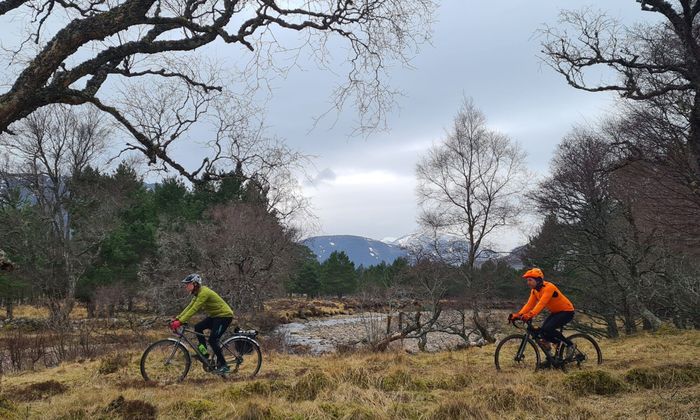
Follow this track for 4.5km when the track will take a sharp turn to the left and you will see a grassy track that goes straight on. Take this grassy track and follow it downhill for 500m to a gate followed by a bridge that opens out into grassland.

Follow the grass track right after the bridge, to meet the river and continue keeping the river on your right. The track goes through another gate and becomes a driveway and eventually – 3.5km after the bridge – comes to the Rannoch Loch road. Turn right on the road and follow it for 8.5km back to the carpark.

Route Map
Local Services
Discover and support local businesses along the route.
Bike Services & Rentals
If you're in need of some extra supplies, a hand with some quick bike repairs or looking to hire something new, you can rely on our trusted friends below.
