
Overview
Route Details
- This route explores traffic free cycle paths to take you out of the city
- Parking may be an issue on busy days in Perth ie festivals etc

Route Video
Route Description
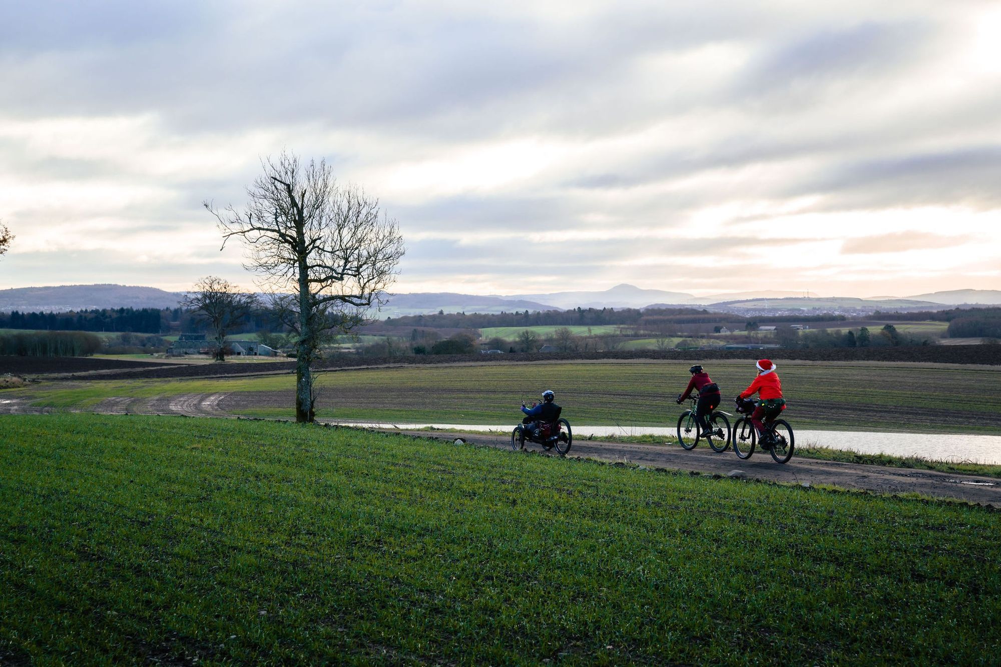
Adaptive gravel routes have been ridden and audited by Adaptive Riders Collective. Perthshire Gravel supplies maps, GPX data, a description of the trails and images of any obstacles so that riders can make their own decision of route suitability for their equipment and ability.
Please also be aware of how weather can affect trail conditions.
Adaptive routes are more likely to be suited to less-skilled riders, families towing cycles or trailers, riders of tricycles, or riders unable to manage lifting cycles over gates or fences. Whilst every endeavour is made to clearly describe routes and obstacles, Perthshire Gravel does not control or regularly review routes and therefore makes no guarantee of accessibility.
The Route
NOTE: this route can be started anywhere along its length - Perth, the Destiny Bridge, Luncarty, Bankfoot, Pitcairn Green or Almondbank.
After parking at Bells Sports Centre head left (North) onto the North Inch park path. Follow this path through the park and alongside the River Tay and River Almond for 3.9km (Look out for NCN Route 77 signs).

You will ride under two bridges - take the sharp left turn before the 3rd bridge signposted Route 77 and Luncarty (you will see graffiti art on this bridge - you will have a chance to ride past it on the way back).
Ride up the embankment then turn right onto the road, over the bridge and right again down continuing on Route 77. You will head back under the bridge with the graffiti art on, before taking a sharp turn up to the left.

Continue on the cycle path alongside the A9 and under the Destiny bridge / Cross Tay Link road. There are diversions down to the Tay if you want to see the river from under the bridge, as well as picnic tables. There are carparks and EV charging here, if you'd like to start your ride at this point.
The route takes a sharp right away from the A9 at 5.9km, goes over the railway and thought Rewilding Denmarkfield - a 90 acre rewilding project including community allotments. Continue following NCN Route 77 signposted up into Luncarty, following the road round to the left then taking the first right hand turn. At the T-Junction turn left then right at the mini roundabout.
Continue out of the village on the main road before taking the first road on the left under the railway and then immediately right - following signs for NCN 77.
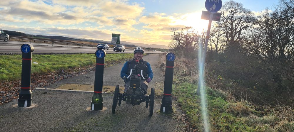
Continue on the cycle path alongside the A9, passing over the A9 at 10.8km and then continuing alongside the other side of the road. You will pass through some barriers (110cm apart) before going onto a quiet road that brings you up to the Perth Road.
Turn left onto the road - enjoy a coffee stop (Disabled toilets available) at Taste Perthshire. Continue along the road into Bankfoot, after 14.4km turning left over the Garry Burn just before the centre of Bankfoot, along Prieston Road towards Tullybelton.
Follow this road until 18.7km when you turn right towards Little Glenshee.

At 19.8km the road curves right and you will take the farm track to the left. There is a waymark sign for Saddlebrae Wood via Blackhill.

Follow this gravel road, passing a few drives to farms and houses for 5km, enjoying views of the Lomond hills in Fife in the distance.

At the end of the track turn right onto the road and down through the small village of Moneydie, then over the cross roads heading towards Pitcairngreen. Drop into the village and turn left, following the road around to the right alongside the village green to the The Pitcairngreen Inn if you fancy a pint. Then head out of the village and down into Almondbank. As the road takes a turn down to the right over a bridge you will turn left onto College Bank Road, picking up the signs for NCN Route 77 again.
You will pass another coffee opportunity - the Tickled Trout which has disabled toilets and the unique experience of a café with a stream running through it.
Follow the NCN Route 77 signs up and over the River Almond before staying next to the bank of the river alongside houses. The path narrows here. Continue along this cycle path under the bridges and all the way back to The North Inch and your parking.
Keep a look out for signs of beavers in the River Almond about 1km after you leave Almondbank!

Route Map
Local Services
Discover and support local businesses along the route.
Bike Services & Rentals
If you're in need of some extra supplies, a hand with some quick bike repairs or looking to hire something new, you can rely on our trusted friends below.
- J M Richards Cycles -Bike Repair
- The Bike Station -Bike Repair
