Overview
Route Details
Route Description

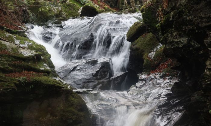
The route starts outside the Birks Cinema in the centre of Aberfeldy. It follows the A 827 and then turns south on the A 826. Shortly afterwards the route follows a footpath through a small park, continuing on the western side of the Birks of Aberfeldy. Originally called the Den of Moness, the birks (from the Scots for birch trees) overlook the Falls of Moness and line the slopes of the Moness gorge. Some sections are steep and nearer the top there are a few wooden steps and a small bridge that require getting off the bike and pushing.
On the top of the gorge the route continues on a private road. At Urlar Farmhouse a small track follows the fence, where pushing is required for most. It joins a wide and smooth gravel track after the property to a fork. The route follows the path to the right and climbs through moorland, gradually along the Urlar Burn to reach the highest point at 490 m, before passing a small lochan.

From here the route continues on the road towards Kenmore and passes another small lochan on the left until it reaches a forest track. It follows the track towards Balmacnaughton, where a double track known as the Queen’s Drive, in memory of Queen Victoria’s visit to the area in the 19th century, leads to the Falls of Acharn, situated in a spectacular wooded gorge. The route follows the Queen’s Drive on the western side of the falls, where a small man-made cavern, known as the Hermit’s Cave, invites to rest. The descent towards the road on the southern edge of Loch Tay is steep and loose, so extra caution is needed here.
From here the route follows Sustrans NCN 7 on the southern shores of Loch Tay to the Scottish Crannog Centre. This small museum is the reconstruction of an Iron Age crannog. Crannogs could be found all over Scotland from about 5,000 years ago up to the 18th century. The museum has a gift shop, and a small cafe is nearby. The route follows the road into Kenmore, a small village with a hotel and a shop, located at the mouth of the River Tay.
The Kenmore Hotel, commissioned in 1572, is reputed to be Scotland’s oldest hotel. The route follows a small road along Loch Tay before crossing the river that drains out of the loch on a bridge and then heads eastbound. At the end of the village a gravel track leads up Dunmore Hill, where a smooth and wide gravel track gradually climbs through a dense forest to a viewpoint, which offers amazing views over Kenmore and Loch Tay. The route continues on forest tracks to the highest point at 380 m, with a great descent into Glen Lyon, billed as Scotland’s longest, loneliest and loveliest glen.
Shortly after leaving the forest the route continues on Duneaves Road and then follows a track towards the river to Duneaves Suspension Bridge. Behind the bridge to route joins the road for a detour to Fortingall, to visit one of the oldest trees in Britain, the Fortingall Yew. Standing in the grounds of the church, it is an ancient European yew, with modern estimates believing it to be between 2,000 and 3,000 years old. A small hotel offers food and rooms, while the street lanterns in the village are very distinct.
The route follows the road on the northern side of the River Lyon to Coshieville. At Coshieville the route joins the B 846 to Trinnie. After the bridge on the left a trail, signposted to Aberfeldy, leads through a small forest to the river bank, and then follows the Tay through the Appin of Dull. Castle Menzies and Highland Safaris are signposted stops not far off the route. A small tarmac path leads back onto the B 846, and over the Wade Bridge into and past the Black Watch memorial to Aberfeldy.

Route Map
Local Services
Discover and support local businesses along the route.
Bike Services & Rentals
If you're in need of some extra supplies, a hand with some quick bike repairs or looking to hire something new, you can rely on our trusted friends below.
- Escape Route Cafe -Bike Shop, Cafe
- Beyond Adventure -Outdoor Guide, Bike Rental


